In 2024, under the supervision of Isabelle Laffont-Schwob and Alex Baumel, Amine Mahdjoub conducted a review of environmental data and produced several maps and analyses for the project. His work concerned principally the anthropogenic pressures which converge on the coastline, in French we call it « littoralisation ». Amine contributed also to the field work on germanders and he did a first environmental niche modelling of germanders. He is now in Berlin for a phD in freshwater ecology (www.igb-berlin.de).
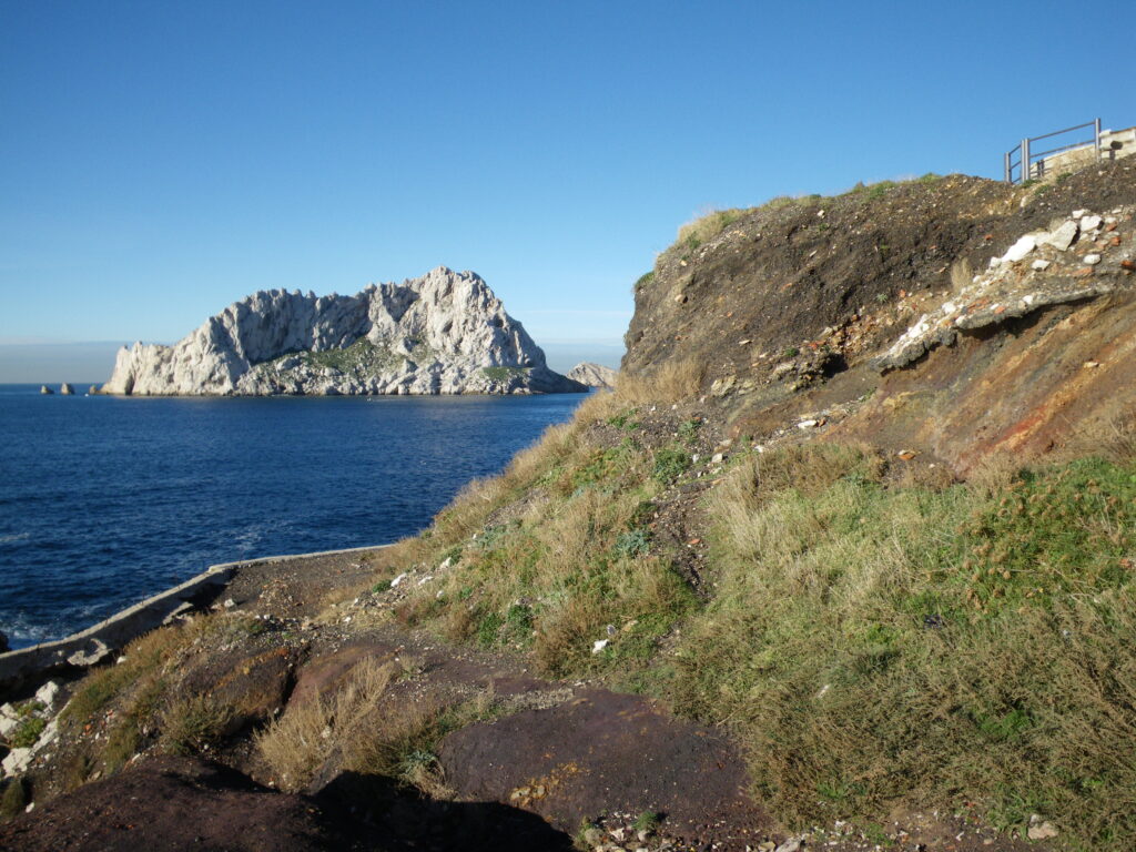
Callelongue : example of pollution, credit photo A. Baumel
Abstract of Amine’s report (Mahdjoub 2024, Master GEMAREC, Univ Lorraine):
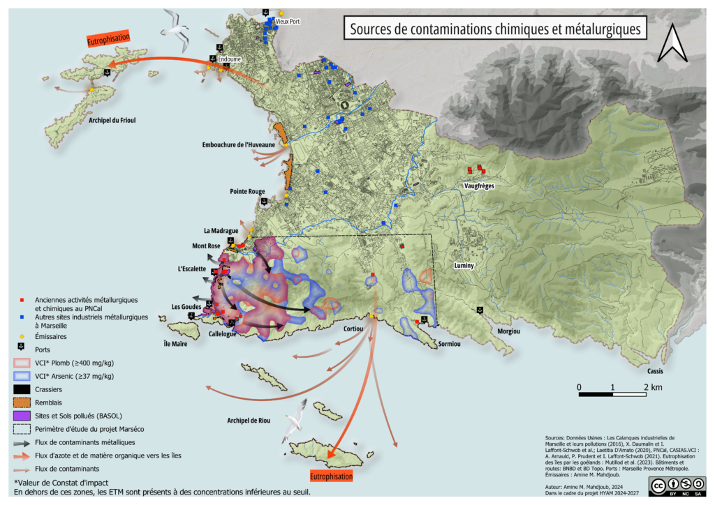
Coastal regions are areas of environmental transition marked by strong anthropogenic pressures, making their ecosystems particularly vulnerable to disturbances. The HYAM project (HYbridization and Adaptation in a Mediterranean coastal city) focuses on studying genetic exchanges and hybridization within a context of intense coastal urbanization in Marseille, a city where socio-economic issues have often overtaken importance over environmental concerns. This work constitutes the first phase of the HYAM project, aimed at characterizing the environment of the south of Marseille by compiling data on anthropogenic pressures. Three thematic maps summarizing anthropogenic pressures were produced: the first shows the sources of chemical and metallurgical contaminations as well as their dispersion pathways; the second map presents sources of geomorphological pressures; and the third map details major disturbances such as forest fires and gorgonian necrosis events. A sampling strategy based geographic information of contaminations and on species distribution models results for germanders and gorgonians was established. Measurements of heavy metals conducted on germander leaves sampled in the past (19th and 20th centuries) and in recent years show that the highest concentrations are found in the area around Mont-Rose (the former industrial zone), where the presence of heavy metals such as lead and arsenic is still detected. Finally, a geographic information system (GIS) was set up on a local server for use by the project partners.
The report of Amine Mahdjoub is available on demand.
First map: review of pollution
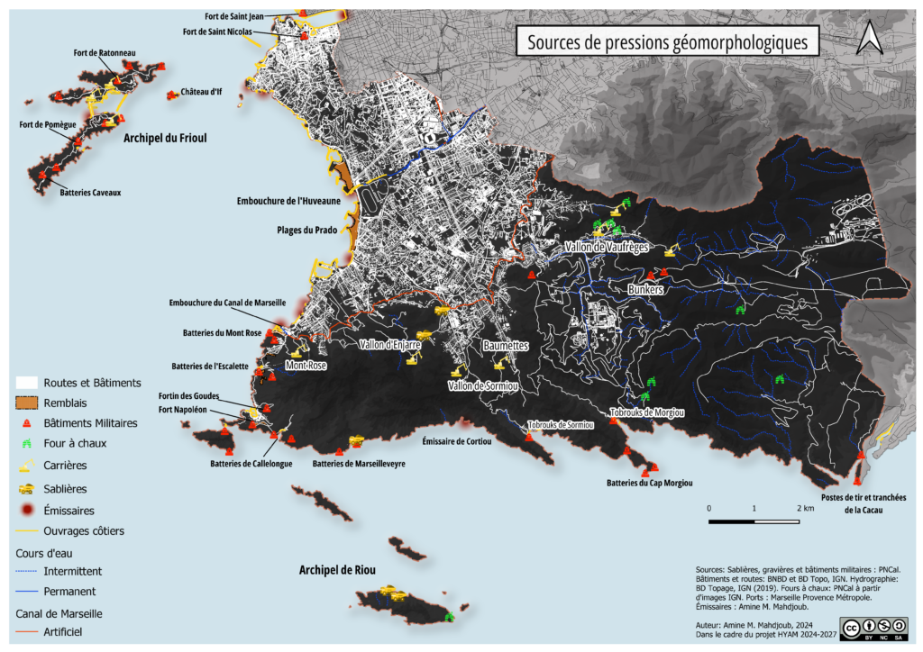
Second map: summary of geomorphological pressures